“On the mountains of truth you can never climb in vain: either you will reach a point higher up today, or you will be training your powers so that you will be able to climb higher tomorrow.” – Friedrich Nietzsche
Some say, before you go climb one of the tallest mountains in the world or perhaps Malaysia’s highest peak, you can test out your will and capabilities at Gunung Nuang, the highest mountain in the state of Selangor. Standing tall at a height of 1,493 meters (4,898 ft), Gunung Nuang can be seen from Kuala Lumpur or Genting Highlands. The mountain is partly covered with gravels, dirt roads with thorns, roots, mud, and trees with streams.
Head for the hills
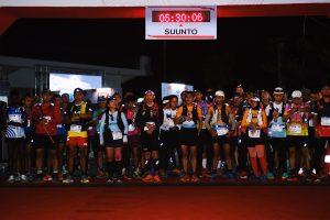
There was a light rain before a group of my friends and I started our journey to conquer Gunung Nuang, yet that didn’t falter our determinations to go and push this adventure. Since this wasn’t my first time climbing Gunung Nuang, I was aware that it would take us about 5-6 hours to trek in our comfortable pace, so we started our day early and went for the hike by 6am. It was about 90 minutes of drive from my house to Village Pangsoon—the entrance to Gunung Nuang.
There are three hiking routes that lead to the peak. The two that start from the state of Selangor side are at Village Pangsoon in Hulu Langat and the shorter route in Janda Baik. The third path is from Bentong in the state of Pahang, which starts from Bukit Tinggi. These routes are built by the Malaysian Department of Wildlife and National Parks.
Before we went for a hike, we did our personal checking of gears to ensure that we brought all the necessities such as food, water, headlights, etc. It is common to see people hiking up with all their camping gears along with them for an overnight adventure at the Pacat or Lolo campsite. We went for the day hike this time.
Head for the amazing trek
The rain shower has passed, yet the soil remained wet and muddy. I anticipated that this to be a more strenuous hike than my first time. Nevertheless, that drove me even more, to see how far I could go and challenge myself to push my own limits.
In this trek, there were 3 stages;
- 1st stage — we trekked for 5km from the entrance at Hulu Langat until Lolo Campsite. This campsite has 5 shelters where we took a five-minute break
- 2nd stage – we hiked for another 1.5km from Lolo campsite to reach Pacat Campsite through which most hikers spent the night at this campsite
- 3rd stage – it was about 3.5km away from Pacat Campsite to the peak
From Hulu Langat entrance until we reached the first small stream, the route was composed of uphill and downhill course which we called it “Never ending road”. Other than the road felt like not ending, we had to take the same road again when descending, so it looked like a never ending thing.
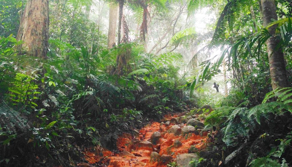
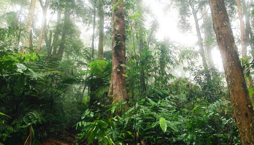
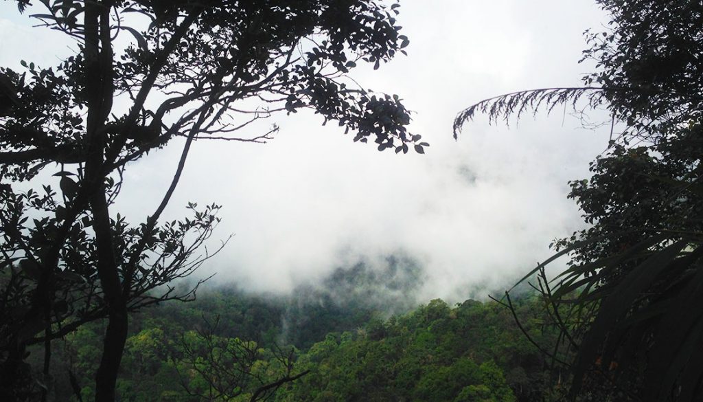
At 7.30am, due to the gloomy weather, the sun wasn’t rising yet and still pitch-dark inside the forest. With the help of our headlights, we navigated easily through the dark wilderness and muddy terrain. Even the so-called never-ending dirt road still had its end, next to it was one slow-flowing small stream that we had to cross and right after that was a jungle track. The trees were slanting over the muddy ground and the leaves brushed up against us. The morning dew tasted both sweet and fresh, like flowers bloomed on our tongues.
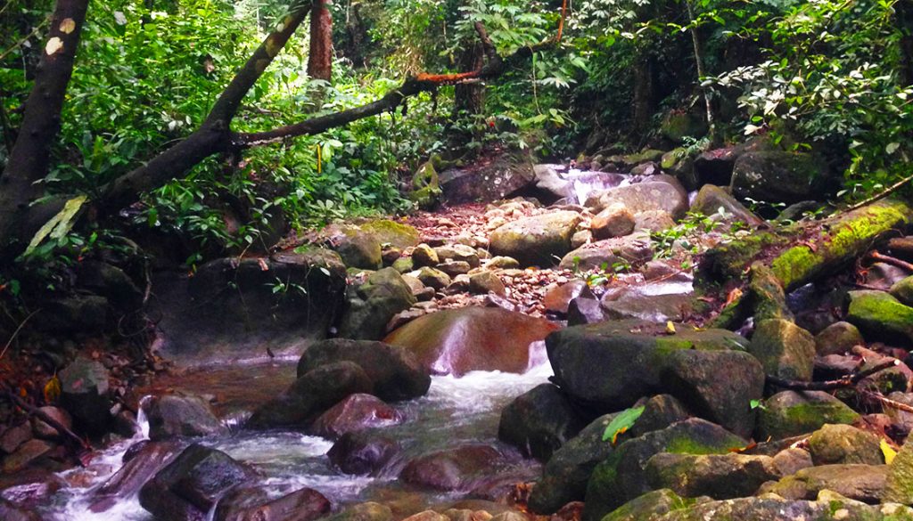
After the dense canopy of jungle track, we crossed a small river. We could see long pipes. Once the old dam came into the view, we already saw the 2nd river crossing. Near at the old dam, it was a waterfall where the white water cascaded down rapidly and it flowed on its nonchalant way. In Lolo Camp, 5 shelters were just for the hikers. We took a 5-minute break there before we continued our journey towards the peak.
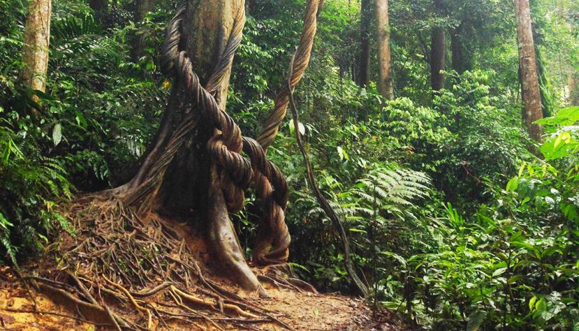
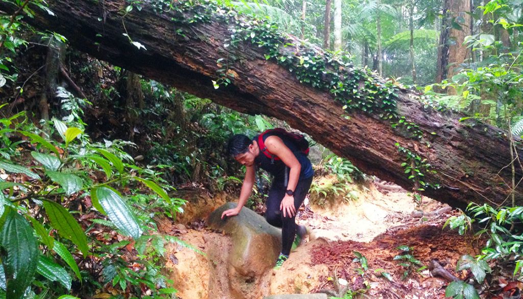
From Lolo Camp, we crossed two rivers until we reached Pacat Camp, “Pacat” in English means “leech”. Some of the hikers said there’re a lot of leeches around this place, hence the camp name. Luckily we didn’t encounter any leech during our trek. The most challenging part was the muddy and damp trail after the two rivers and my shoes were literally sinking on the ground. It’s more difficult to walk with that kind of ground condition and not to mention the already steep trail. Even though, there were ropes on some part of the hill to help hikers but it’s still tiring to lift yourself up.
Reaching the top
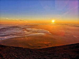
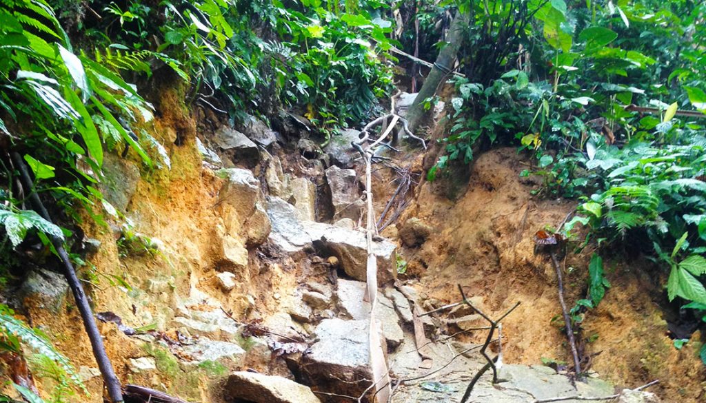
We walked for another 3.5km in our wet bodies and heavy feet. It’s a long stretch but I knew everything was worth it once we reached the top. Below our feet were only browned remnants of branches and needles that may have fallen in the recent high winds and rain. The sun was slowly peeking through the trees and illuminating the green background. The air remained rich with the fragrance of leaves and damp loam, this was the forest natural scent.
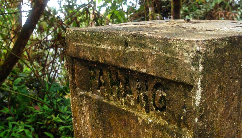
Ten more steps, no, I thought it’s around seven or maybe five. Well, I lost count already on how many steps we took, we finally reached the peak. It’s not the kind of peak where you could see an overlooking view of the city, on the contrary, you could see nothing but only towering bushes. There at the summit was the stone border of Pahang and Selangor standing in two states at once. If you want to make it to the summit of Gunung Nuang, you definitely have to bring a windbreaker or warm blanket with you as it’s freezing cold up there.
We had our lunch at the peak of Gunung Nuang after almost 5 hours of rigorous trekking. Having our lunch while embracing the natural beauty of this hill was more rewarding than having to look at any amazing view at the top, well, that would be an added bonus. Without that, the hike was still as wonderful. Sometimes, the real journey is not about where you are going, it’s how you get there.
This was my second time climbing the Gunung Nuang, I kept on saying to myself that I didn’t want to climb the same mountain twice, yet I went there again. So, if you ask me whether I am going to climb this mountain again, I will say no. No one can foresee the future, I might be at the peak of Gunung Nuang again.
Credit: Paun Cher Chin